Walking
Pedestrian Priority on Campus
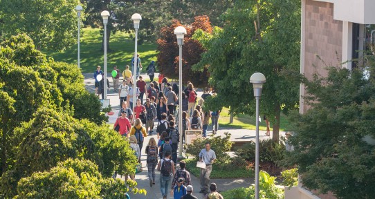
UVic has always been a campus designed for walking.
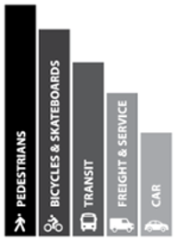
The Campus Plan identifies walking as the highest priority for the campus. This includes:
-
a commitment to walkability
-
a focus on pedestrians within Ring Road
-
a strengthened pedestrian network
-
diverse connections that make walking and wheelchair use safe, accessible, and enjoyable.
Safety for Pedestrians
Safety and Security is a priority in the Campus Plan to create a pedestrian and barrier free design on campus. To enhance the sense of safety, especially during the evenings, UVic is working to:
- Design transparent building facades
- Place and orient buildings and active uses to provide natural surveillance
- Provide pedestrian-oriented lighting
- Maintain strong campus enforcement
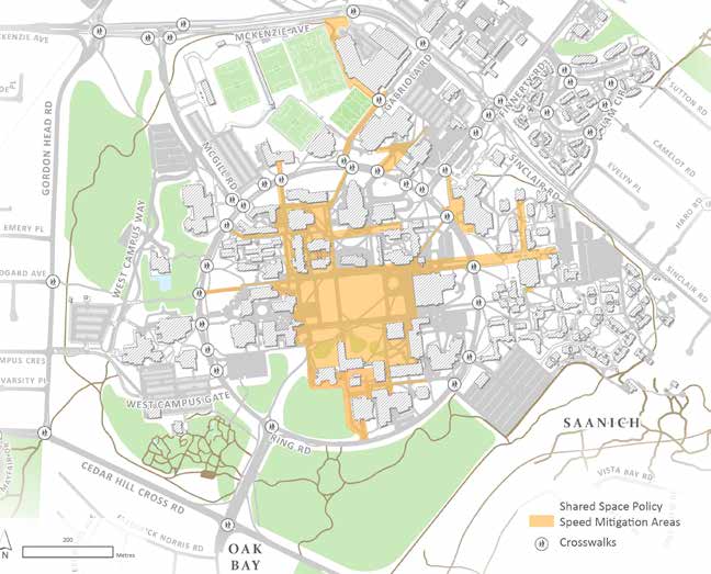
The Campus Cycling Plan identifies a "Shared Space" strategy to improve pedestrian-cyclist interactions on campus. This includes:
-
Prioritizing pedestrians as the primary user with the right of way at all times
-
Promoting respectful active transportation etiquette and awareness in designated Shared Space areas
-
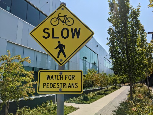
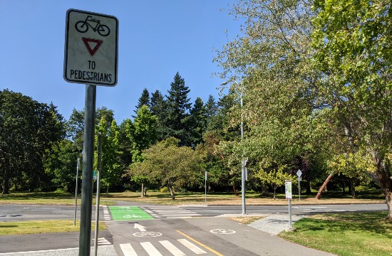
Implementing signage and slow zones to manage cyclist speed
A shared space policy is recommended within Ring Road (especially the Quadrangle area), around the Centre for Athletics, Recreation and Special Abilities (CARSA), the Student Union Building and McKinnon Building/transit exchange.
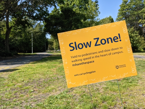
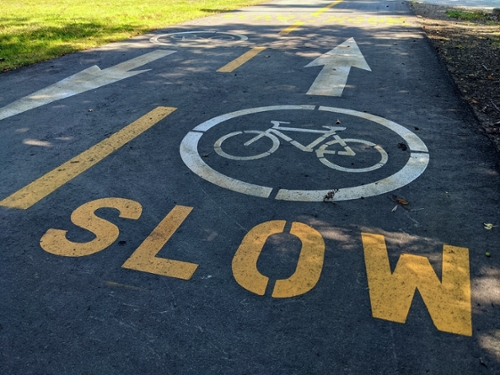
In shared spaces on campus, pedestrians have the right of way and cyclists should slow down to walking speed to #sharethespace
Slow Zones
The Campus Cycling Plan recommends that speed management actions be implemented in the core areas of campus, including slow zones, design interventions (i.e. speed bumps, planters and other physical barriers) and pedestrian harbours to facilitate safe and respectful sharing of space.
When walking on campus, keep an eye out for signs marking the transition from separate cycling paths to areas shared with pedestrians. In these areas, pedestrians are given the right of way and cyclists are asked to please slow to walking speed and yield to pedestrians.
As part of the Campus Cycling Plan Implementation, the following Shared Space and Safety projects have been completed:
- CARSA Pathway "Slow Zone"
- Central Campus "Slow Zone" at University Drive
Separated Pathways
The Campus Plan identifies several mobility policy directions to create a pedestrian design on campus:
- Reinforce a well defined pedestrian network with a clear structure of both direct and meandering connections that include trails, sidewalks, pedestrian paths, shared paths, separated
paths, and promenades. - Reinforce and establish strong direct connections and well-defined view corridors through campus and across Ring Road
University Drive Connection Pathway
- The University Drive Connection Pathway links University Drive and Ring Road with the heart of the campus, and with Oak Bay's Henderson Road bike corridor to the south.
-
The pathway improvements include:
- Separated cycling and pedestrian pathways
- Intersection crossing improvements
- Bicycle and pedestrian pathway counters
- New lighting
Campus Greenway
- The UVic Campus Greenway is planned to be the primary east-west Greenway across the campus.
- Once completed the Campus Greenway will create vibrant hubs connecting buildings and public spaces on campus and will act as the primary multi-modal pathway between Gordon Head Road and Sinclair Road.
- Construction has begun on the western most segment of the Campus Greenway from Gordon Head Road and Midgard to Ring Road near Fine Arts. Watch out for pathway closures and detours as we build new pedestrian and cyclist separated pathways.
Trails and Paths
The UVic Campus Plan outlines the following policy direction: Continue to maintain the
existence of trails and paths throughout campus, including to and through natural areas and gardens.
Trails and Paths for Pedestrians on Campus:
- Finnerty Gardens
- Mystic Vale
- Bowker Creek
- Alumni Chip Trail
- Map of Uvic Green Spaces
- UVic jogging map