Problematic Polygons
The Ethnographically-Informed Cartographic Alternatives for Representing Indigenous Territorial Relations project by UVic student Rachel Stewart-Dziama and professor Brian Thom through CICADA’s mapping axis, and in partnership with the Hul’q’umi’num Treaty Group aims to re-imagine map-based visualizations of Indigenous peoples’ territories through cartographic experimentations.
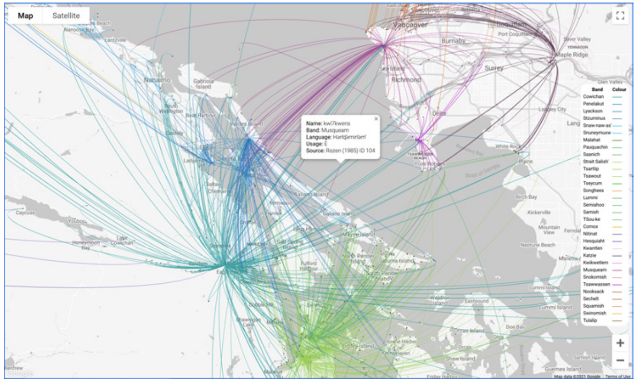
Elders have long expressed their frustrations with making territorial maps with deceivingly simple boundary lines, lines that negate the relational nature of Indigenous connections to territory. Anthropologists' continued use of “polygons” to encircle Indigenous territories exacerbate troubling language of overlapping land claims and risk perpetuating unintended assumptions about the nature of property, jurisdiction, and cultural practices that go with conceptualizing territory as fixed and contiguous.
Stewart-Dziama and Thom’s experiment works toward living up to Elders’ expectations, where maps are able to accurately depict relationships, networks, and long-standing connections to place. This project uses deck.gl programming script to create an image of Indigenous territoriality based on dynamic radiating lines that highlight networks of relationships of people to places.
Resources
Available in English, French, and Spanish
https://cicada.world/files/newsletters/CICADA-newsletter-05-EN.pdf#page=4
https://cicada.world/files/newsletters/CICADA-bulletin-05-FR.pdf#page=4
https://cicada.world/files/newsletters/CICADA-boletin-05-ES.pdf#page=4