Kamchatka Indigenous mapping
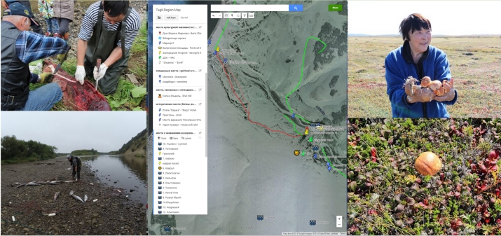
UVic Anthropology's Ethnographic Mapping Lab was invited by the Russian Association of Indigenous Peoples of the North, Kamchatka Region (AIPON-Kamchatka), to launch a research project of computer-aided cultural mapping. AIPON-Kamchatka is working to document and celebrate traditional Itleman, Koriak and Chukchi language, heritage and culture.
Through this project, youth, elders and researchers are working together to map out the histories of special cultural places, and their Indigenous language place names using Google Earth and Android mobile devices. The digital atlas products will be used in schools in the Kamchatka region, and in local cultural centres to engage youth and communities in their cultural landscapes.
Visit the project's website for more information and resources (in Russian and English).
Kovran Village Map (English) - Ковран деревня
Tigilslki-Region Map (English)
Publications from this project include:
Thom, Brian, Ben Colombi, and Tatiana Degai (2016) Bringing Indigenous Kamchatka to Google Earth: Collaborative Digital Mapping with the Itelmen Peoples. Sibirica. 15(3):1-30. http://dx.doi.org/10.3167/sib.2016.150301
Colombi, Benedict, Brian Thom and Tatiana Degai (2018) Googling Indigenous Kamchatka: Mapping New Collaborations. Pp. 195-203 in Indigenous Justice: New Tools, Approaches, and Spaces. Edited by Hendry, J., Tatum, M.L., Jorgensen, M., and Howard-Wagner, D. Palgrave Socio-Legal Studies. https://dx.doi.org/10.1057/978-1-137-60645-7_13