UVic archaeologist finds sites, makes history

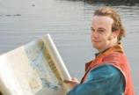
A UVic anthropology instructor and recent PhD graduate Duncan McLaren has collaborated in the discovery of archaeological sites dating to more than 5,000 years old in Coast Tsimshian Territory, on the northern coast of British Columbia.
This research has “almost doubled the length of known occupation from 5,000 to 10,000 years” in that region, says McLaren’s PhD supervisor, archaeology professor Quentin Mackie.
This is a significant achievement, considering that archaeologists have been working in the region for nearly 50 years.
McLaren and a research team headed by David Archer of Northwest Community College and Andrew Martindale of University of British Columbia successfully located the sites by reconstructing the sea-level and palaeo-environmental histories of the Dundas Islands and by conducting archaeological surveys.
McLaren undertook the work for his doctoral dissertation. He hypothesized that the Dundas Island archipelago would be what is known as a sea-level hinge.
He explains that this hinge would have experienced little shoreline movement, whereas the landforms adjacent to it have undergone dramatic changes in sea-level, mainly due to glaciation. During the last ice age the mainland of British Columbia was depressed downwards as a result of the weight of ice on top of it. Adjacent areas, such as Haida Gwaii, bulged upwards.
Using his forearm as a model, McLaren demonstrates the theory:
“Imagine that my hand is Haida Gwaii and my elbow is the mainland. In the middle is the sea-level hinge. That’s the Dundas Islands area.”
McLaren’s arm moves up and down like a teeter-totter, illustrating how the land masses would have moved under such tremendous weight.
Following the ice age, sea-level gradually dropped 200 metres on the mainland as the continental crust rebounded and simultaneously rose 150 metres on Haida Gwaii as the bulged area subsided.
“If shorelines were changing, then the places where habitations were situated would have changed as well,” explains McLaren.
Conversely, if sea-level remained fairly stable, coastal dwellers wouldn’t have had to move as often. Grandchildren and grandparents would have lived at the same site.
To help find these areas of sustained habitation, McLaren constructed a sea-level curve, which approximated the location of slightly raised shorelines over a 12,000-year period.
To create the curve, McLaren used a range of dating methods including lake coring, pollen analysis, radiocarbon dating and diatom identification. Diatoms are the microscopic silica skeletons of phytoplankton.
Once he had established the sea level curve, he created maps which pinpointed the probable locations of archaeological sites on the ancient shorelines.
“Finding archaeological remains on ancient landscapes is like looking for a needle in a haystack: you can’t make any more needles, but accurate environmental reconstruction in effect makes the haystack much smaller,” says Mackie.
After three months of fieldwork in this metaphorical haystack, McLaren identified 12 different sites, all which lie on slightly raised marine landforms. Five of the sites date to the early Holocene period, between 10,000 BP and 5,000 BP (before present).
McLaren has presented his findings at a meeting with Lax’Kw’alaams elders, who had granted him permission to conduct research in their territory. He says they were very keen to learn about scientific explanations of sea-level change as they had been noticing raised shell deposits for some time. To date, however, the future of the sites has not been decided.
“If I was given the card to go, I would continue with this line of inquiry and keep looking for more sites,” says McLaren. “It’s neat to find a village site that’s been forgotten.”
Photos
In this story
Keywords: uvic, archaeologist, makes, history


