Google trike maps campus
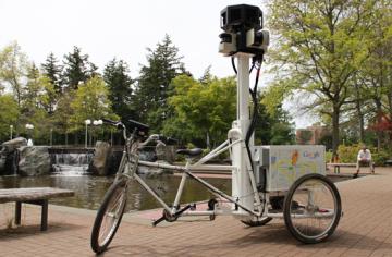
In late May, mapping technicians from Google were at UVic to photograph 360-degree panoramic views of the campus, including pedestrian pathways, trails and parking lots. The mapping information will eventually be available on the internet via Google Street View to assist with wayfinding on the UVic campus and allow visitors, prospective students and employees and others to virtually experience our beautiful campus. The trike is equipped with multiple lenses that capture 360-degree photos and store them in an onboard computer system. Motion sensors track the trike’s position while lasers capture 3D data to determine distances within the Street View imagery.
Photos