Support for Indigenous mapping initiatives
Any map is only as good as the data with which it’s created.
For the Cowichan Tribes, Google maps—likely the most turned-to source of basic location information—showed empty, unused land where in fact hundreds of people, buildings, landmarks and other facilities reside.
officer. Photo: M. Wright.
Google was aware such gaps existed, particularly for First Nations lands, but the data to fill in the blanks wasn’t available through its usual channels such as government and other official sources.
Recognizing the challenge, Google proposed a solution. Cowichan Tribes, BC’s largest First Nation, and thousands of other First Nations across Canada, the US and overseas took part in Google’s first Indigenous Mapping Day on Aug. 9, United Nations International Day of the World’s Indigenous Peoples.
Four Cowichan Tribes members took part in a MapUp event at the University of Victoria anthropology department’s ethnographic mapping lab, organized by anthropology assistant professor Brian Thom and UVic cartographer Ken Josephson.
The all-day event started with an hour of live training via webcam with Google staff, with whom Thom has worked since 2009 through his involvement with Google Earth Outreach and the Google Trainers Network, where they are developing training and research techniques for indigenous land use mapping to support First Nations initiatives.
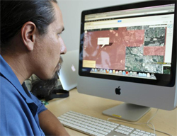
The training session was followed by a full day of adding and correcting location information to Google’s basemap, using Google Map Maker.
“For us, there are some basics like identifying buildings and roads. Our information doesn’t necessarily get out there and community members don’t necessarily know the process for getting it out there,” says Tim Kulchyski, a biologist with Cowichan Tribes. “This is a way to do mapping on a smaller, low-key scale where we can do it ourselves.”
The goal is to enable First Nations to update basic information about their communities (while avoiding any sensitive or traditional information) and fill in the gaps on the map, says Thom, who is also a partner in UVic’s Community Mapping Collaboratory, a SSHRC-funded initiative under Dr. Peter Keller.
“It’s an empowering tool, really,” says Kulchyski. “It’s one of the most effective ways to communicate with people and to relate a huge amount of information. This is going to help develop a more informed baseline for everything.”
Filling in those gaps in public information is also another way to dismantle some of the walls that exist between cultures, Thom adds, by sharing basic knowledge about the First Nations community and educating the general public (Cowichan’s map updates include several traditional Hul’qumi’num names and locations of many important places in the community) in non-intrusive way.
With interest from other First Nations on the Island and Lower Mainland, Thom expects to help make additional similar events happen. Thom also met with Stz'umunis First Nation in Ladysmith, who sent some of its community’s data to enter during the workshop.
“There was definitely a desire to do more, it’s just a matter of keeping the ball rolling,” he says, adding that Cowichan Tribes members headed home with great skills they can share, and a long list of previously collected GIS data that they plan to make available to the world through Google Maps.